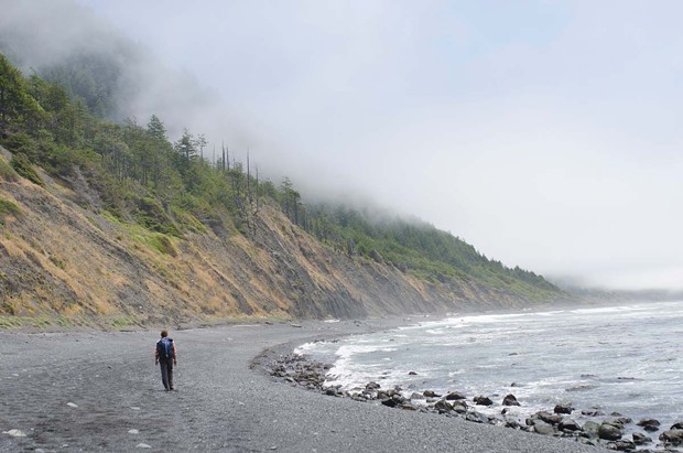
The King Range runs parallel to the Pacific Ocean, and its western slopes fall steeply onto the rocky shores. In 1936, the dramatic landscape made it impractical for engineers to construct U.S. Highway 1 nearby, earning the area the name "The Lost Coast." Today, it's still the longest stretch of undeveloped coast in California. Hiking the 25-mile Lost Coast Trail (or at least part of it), is worthy of anyone's bucket list.
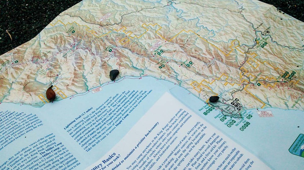
Our group of three (Drew Hyland, Angie Lottes and myself) planned a 9-mile hike to Big Flat and back, along a natural stretch of beach undisturbed by humanity but for a few rough-hewn campsites along the way.
We started out (and recovered afterward) at Shelter Cove, which is tucked into the rugged coastline with gorgeous views and uniquely unseasonal weather patterns. When the rest of the North Coast is covered with coastal fog, Shelter Cove can be sunny and hospitable. But when storms come, the waves, wind and rain can pound the shoreline. (At those times it's best to hole up in a cozy hotel and watch the storm from the comfort of a hot tub.) The marina to the south provides access to the ocean via charter boat and small boat and kayak fishing. There's even a full-service fish cleaning station for the day's catch.
North of town lies the 3.5-mile Black Sands Beach and access to the trail. You can also get on 24.6 miles north at Mattole. The intrepid hiker can cover the trail in two days. High tide necessitates at least one overnight stay.
Backpacks loaded with enough gear and supplies for an overnight excursion, we set out from toward Big Flat, the last point visible from Shelter Cove. We learned we could fill our water bottles along the way at one of several creeks that feed the ocean — a good thing since packing as lightly as possible is recommended when walking on the sand and rocks that make up most of the terrain.
The tide creeping in took us further from the ocean and onto the piled up rocks hugging the cliffs along the narrow shore. Walking on them made me regret all the step aerobics classes I didn't take in preparation.
We stopped to check out tide pools and photo opportunities. It was easy to imagine yourself as the first human that walked along the beach with its calm but powerful waves and the seagulls standing in packs, scattering at your approach.
We went on and paused again for lunch and a much-needed break. The campsites around Buck Creek meander up into a small rise and it was tempting to tell my fellow hikers to go ahead without me. Instead, I sucked it up, strapping on my pack and heading back out after my young friends.
We found some respite from the rocks by walking on packed sand near the water. As the tide rose and the beach narrowed, we moved toward the cliffs, which made for slower going. My legs were heavy as we picked our way along larger rocks. Fewer than two miles from Big Flat, the tide was moving in. There was no outlet along that stretch of beach and we knew that if we didn't beat the tide we'd be swimming.
Urging my stiff muscles into action, I approached a small outcrop as the water got closer. I resigned myself to getting wet and timed my passage with the waves. As I made it past the outcrop, I saw Angie and Drew waiting on the other side — just as a wave soaked my boots. Angie clapped at my amazing dexterity as I muttered an expletive under my breath at the next stretch of rocky beach.
Big Flat is an apt name for this confluence of land and sea. It's a natural campground for hikers coming in either direction on the trail. Off shore, waves broke and curled — fine surfing conditions. Many an avid surfer has hiked the trail with a surfboard in tow for a chance at those waves.
As evening descended, the sea became calm and we were safely tucked into our cozy campsite under the stars.
I woke up sore, but the walk back to Shelter Cove was pleasant with the low tide yielding a less rocky path. We kept a steady pace for the next few hours and stopped for a brief lunch at the 6-mile point — just 3 miles left to go. Did I mention that the first 3 miles were the hardest? Well, on the way back they make up the last 3 miles as well. But once we made it to the hotel, the beer was cold and the tub was hot. I would do it again.
There are not many places left to hike on the California Coast that offer such an untamed landscape or such a direct connection to the sea. Just remember: It's essential to hike at low tide, and to have a cold beer waiting at the finish.

